

When the National Oceanic and Atmospheric Administration announced in late July that the developing El Niño had an 80 percent chance of becoming a very strong event by the end of 2026, the number was a model of scientific precision. It was also, in the eyes of many who heard it, a guarantee.
That gap between how climate scientists communicate risk and how the public absorbs that risk has never mattered more. The El Niño that emerged in June 2026 is strengthening at a pace that has surprised forecasters. By the time it peaks, projected for late 2026 or early 2027, it could shatter every record in the modern observational record by a margin wide enough to redefine what a strong El Niño means.
What the Models See
Zeke Hausfather, a climate scientist at Berkeley Earth, compared projections from 14 separate climate models during the third week of July. The median estimate across all models showed peak sea surface temperatures in the equatorial Pacific roughly 0.8 degrees Celsius (1.4 degrees Fahrenheit) higher than the previous record holder, the 2015-16 El Niño. A margin of 0.8 C above the prior record is not incremental. It is comparable to the entire difference between a weak El Niño and a very strong one.
The NOAA Geophysical Fluid Dynamics Laboratory’s SPEAR model painted an even starker picture. All 30 ensemble members, each a separate simulation with slightly varied initial conditions, produced a peak strength competitive with the strongest El Niño events of the past century. Not most of them. All of them. When the full envelope of possibilities lands in the same territory, the signal is unambiguous.
Michelle L’Heureux, a meteorologist at NOAA’s Climate Prediction Center, described the agency’s forecast in similarly uniform terms. Beyond the 80 percent probability of a very strong event by the end of 2026, NOAA assessed a near-certainty that El Niño conditions would persist at least through April 2027. That duration would push the event into a different category. Most strong El Niños weaken after peaking; a long-lived event of this magnitude would compound the strain on ocean ecosystems and circulation patterns for two full years.
Probabilistic Language, Deterministic Reception
The 80 percent figure is a textbook probabilistic forecast, the kind of language climate scientists have spent decades refining to communicate uncertainty while conveying high confidence. An 80 percent chance means that in 8 out of 10 analogous situations, the forecast outcome materializes. It also means that in 2 out of 10, it does not.
But the public, the press, and policymakers do not naturally process probability that way. Research on risk communication has consistently shown that people hear high probabilities as near-certainties, especially when the stakes are large. The nuance that survives in scientific publications tends to evaporate by the time it reaches headlines, planning documents, and insurance assessments.
This is not merely semantic. Disaster preparedness, humanitarian budgeting, and economic forecasting all rely on probabilistic inputs. When those probabilities are compressed into deterministic expectations, the response swings between two equally costly errors. Overpreparation wastes resources and erodes trust. Underpreparation amplifies damage. The 2026 forecast, with its unusually high model agreement and potential for historic impacts, makes this tension impossible to ignore.
The Economic Calculus
Justin Mankin, a climate researcher at Dartmouth College, has attempted to quantify what a record-breaking El Niño would cost. Drawing on prior research published with coauthor Christopher Callahan in Science in 2023, which showed that the 1997-98 El Niño shrank global economic output by approximately $5.7 trillion, Mankin estimated that a 2026 event could produce cumulative losses reaching $10 trillion by 2032.
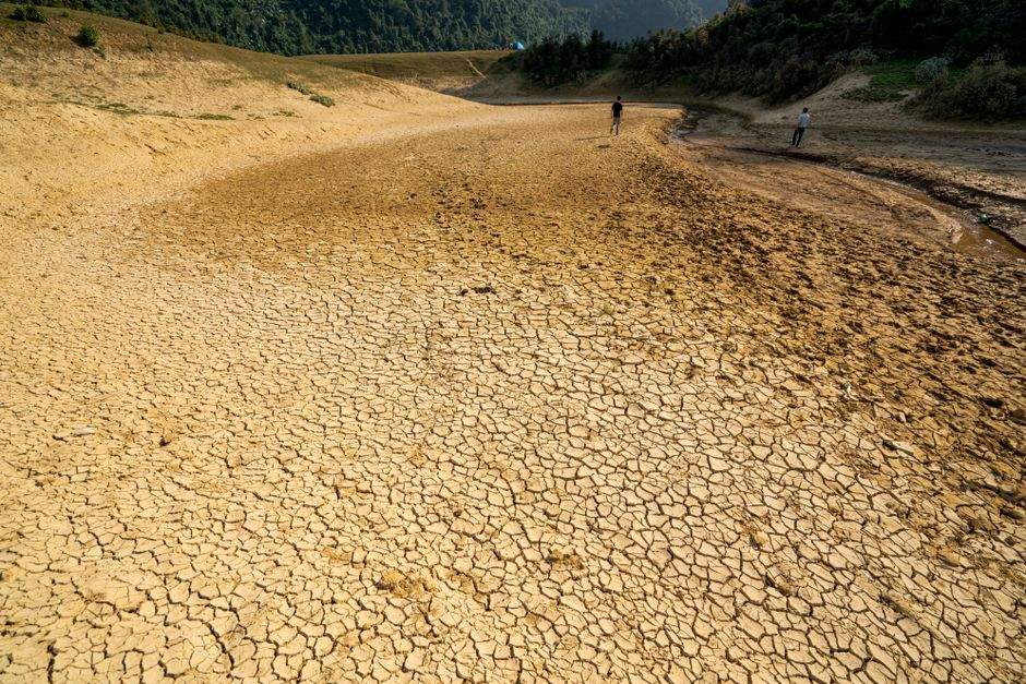
That figure includes direct damage from extreme weather: floods along the Pacific coast of South America, drought and wildfires in Southeast Asia, and disrupted agricultural seasons across the tropics. It also accounts for slower-moving effects: suppressed labor productivity in heat-exposed regions, reduced yields that ripple through commodity markets, and the compounding drag on growth when multiple regions suffer simultaneous shocks. The 1997-98 event demonstrated this pattern. Crop failures in Indonesia and Thailand sent commodity prices spiking worldwide. The Amazon experienced severe fire seasons. Coral reefs across the Pacific sustained bleaching from which many have not recovered. The economic toll was measurable years after ocean temperatures returned to normal.
The Climate Context
The current El Niño is unfolding on a planet roughly 1.3 degrees Celsius (2.3 degrees Fahrenheit) warmer than pre-industrial levels, a baseline that did not exist during any previous event. That background warming matters because El Niño does not operate in isolation. It interacts with the long-term trend, and the interaction appears to be amplifying the signal.
Research published by Abram and colleagues in Nature in 2020 demonstrated that the difference between El Niño and La Niña states in the tropical Pacific has grown wider under human-caused warming, with sea surface temperature anomalies during El Niño events increasing faster than models had projected. A 2025 study by Coquereau and colleagues in Geophysical Research Letters reinforced this finding, showing that extreme El Niños may become more frequent as the climate warms, driven by changes in the mean state of the Pacific that make it easier for coupled feedbacks to amplify.
The 2026 event fits this pattern. Forecast models suggest peak sea surface temperature anomalies in the Niño 3.4 region, the standard benchmark, may exceed 3.0 degrees Celsius (5.4 degrees Fahrenheit). For context, the 2015-16 El Niño peaked around 2.6 C (4.7 F). The 1997-98 event peaked near 2.4 C (4.3 F). A 3.0 C anomaly would place the 2026 event in a category the observational record, which extends back to 1950, has never documented.
What Happens Next
If the models are correct, and the convergence across 14 independent modeling systems plus the consistency of the SPEAR ensemble makes a strong case that they are, the consequences will extend beyond immediate weather impacts. The global average temperature in 2027 could rise to approximately 1.7 degrees Celsius (3.1 degrees Fahrenheit) above pre-industrial levels, pushed upward by the pulse of heat from the tropical Pacific. That would bring the world uncomfortably close to the 1.5 C threshold established by the Paris Agreement.
Even 2026 itself, before the El Niño has fully matured, is on track to become the hottest year in the instrumental record, according to multiple monitoring agencies. The combination of long-term warming and the developing El Niño has pushed global temperatures into territory scientists did not expect to see this decade.
Carbon uptake by oceans and terrestrial ecosystems is also projected to decline. During previous strong events, the net carbon sink has dropped measurably, as drought-stressed vegetation and warmer ocean surface waters reduce the efficiency of photosynthesis and gas exchange. A decline during a record-strength El Niño would mean more human-emitted CO2 remains in the atmosphere, accelerating the very warming the event exemplifies.
The Certainty Trap
The 2026 El Niño forecast is, in one sense, a triumph of climate science. Fourteen models built by different research groups on different continents have arrived at the same conclusion: something unprecedented is underway. The 80 percent probability from NOAA, the 30-member ensemble from GFDL, and the cross-model median from Berkeley Earth all point in the same direction.
The trap is that this convergence could create a dangerous illusion of predictability. Climate models are not crystal balls. They are tools for bounding risk, not for predicting the future with certainty. The 2026 El Niño will almost certainly be very strong, possibly the strongest on record. But it will not unfold exactly as any single model run projects. Its impacts will depend on timing, on the background state of the atmosphere, and on weather systems that interact with the broader tropical circulation.
The real lesson of the 2026 forecast is not that the record will break. It is that the climate system is sending signals scientists can now read with remarkable clarity, and that the gap between what the science says and what the world hears has never been wider or more consequential. Bridging that gap will require more than better models. It will require a shared understanding of what probability means when the stakes are measured in trillions of dollars and the stability of the only climate the planet has.
The models have converged. The challenge now is making sure that convergence translates into action, not just headlines.