

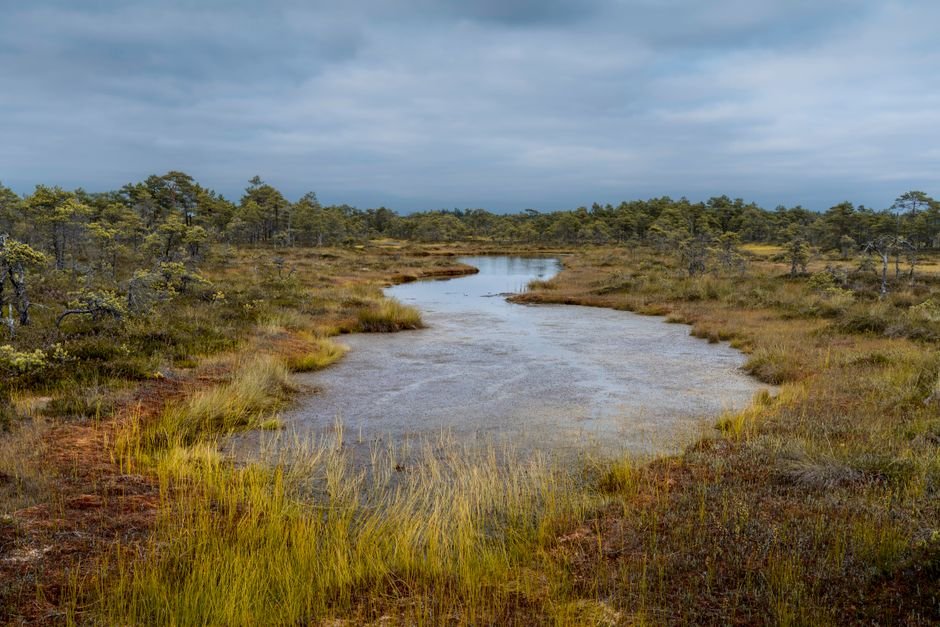
A new generation of high-resolution satellite maps, powered by machine learning, has revealed the true extent and fragmentation of European wetlands, uncovering overlooked patches of these vital ecosystems and providing a foundation for restoration efforts across the continent.
Wetlands are disproportionately important ecosystems. They cover only 5 to 8 percent of Earth’s land surface but store 20 to 30 percent of its soil carbon, making them critical both for biodiversity and climate regulation. Yet human activity has drained, paved, and plowed through them for centuries, releasing stored carbon into the atmosphere and reducing habitat for the species that depend on them.
The new research, published in Nature by Kovács and colleagues, uses satellite imagery analyzed by a machine-learning algorithm to produce the most detailed maps yet of European wetlands. The results paint a sobering picture: a highly fragmented landscape where the remaining wetland patches are far more numerous but far smaller than previously recognized.
Why accuracy matters
Previous wetland maps relied on coarse satellite data and ground surveys that were expensive to repeat. The new approach processes high-resolution imagery through a convolutional neural network trained to recognize wetland characteristics, water saturation, vegetation type, spectral signatures, and seasonal moisture patterns, across the entire European continent.
The algorithm identified wetlands with far greater precision than earlier efforts, picking out small patches that older maps missed entirely. These “overlooked patches” turn out to be ecologically significant: small wetlands can serve as stepping stones for migrating species, buffer zones against flooding, and localized carbon sinks.
The finding has direct policy relevance. The European Union’s Biodiversity Strategy for 2030 includes binding targets for wetland restoration, but effective restoration requires knowing where the remaining wetlands are, what condition they are in, and which areas offer the most potential for recovery.
A fragmented picture
The high-resolution data reveals that European wetlands are more fragmented than previously understood. The total area is roughly in line with earlier estimates, but the distribution is far more scattered. Many small patches survive in agricultural and urban landscapes, often unrecorded in national inventories.
This fragmentation has consequences. Wetland biodiversity depends on connectivity, a network of marshes, bogs, and fens that allows species to move, disperse, and maintain genetic diversity. A single large wetland surrounded by farmland is less resilient than a cluster of smaller ones connected by corridors of suitable habitat. The new maps can identify where those corridors exist and where they have been severed.
The study also identifies regions with the greatest restoration potential, areas where drained or converted land sits adjacent to surviving wetlands, making reconnection feasible. This kind of spatial planning, the authors argue, is essential for meeting both biodiversity and climate goals.
Carbon beneath the surface
The carbon stored in wetland soils is the product of thousands of years of accumulation. Wetland plants photosynthesize, die, and decompose slowly in waterlogged, oxygen-poor conditions, trapping organic carbon in peat that can be meters deep. When wetlands are drained, oxygen enters the soil, microbes begin breaking down the organic matter, and the carbon is released as carbon dioxide.
Restoring drained wetlands reverses this process. But not all wetlands store carbon at the same rate, and the new maps allow researchers to estimate carbon storage potential at a resolution fine enough to guide investment decisions, where to spend limited restoration funding for the greatest carbon and biodiversity return.
Beyond Europe
While the study covers Europe, the methodology is transferable. The machine-learning approach can be retrained on satellite imagery from other continents, offering the possibility of global high-resolution wetland mapping for the first time. Given that wetland loss and degradation continue worldwide, driven by agriculture, urban expansion, and climate change, such a global dataset would be a powerful tool for conservation planning.
The authors note that protecting and restoring wetlands is among the most cost-effective nature-based solutions for climate mitigation. The new maps provide the spatial precision needed to turn that general principle into targeted action.
Reference: Kovács et al. (2026). “Highly fragmented European wetlands with uneven restoration needs.” Nature, 655, 932–941. DOI: 10.1038/s41586-026-10760-9
News article: Mitchinson, A. (2026). “Detailed maps of European wetlands reveal overlooked patches of ecosystems.” Nature News. DOI: 10.1038/d41586-026-02211-2