Boulder, Colorado — Weather Stream, a commercial weather satellite operator based in Boulder, Colorado, has released first light imagery from its GEMS2-Amethyst satellite, marking a significant step forward for private-sector atmospheric monitoring from space.
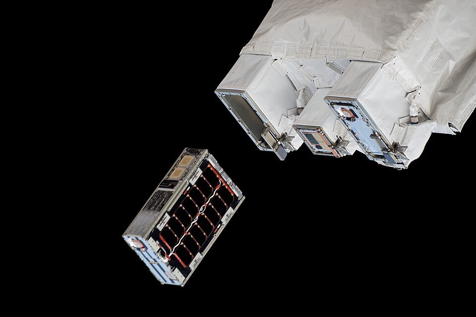
The GEMS2-Amethyst spacecraft, a six-unit cubesat equipped with a dual-band passive microwave radiometer, returned its initial atmospheric observations after reaching operational orbit. The instrument sees through cloud cover and darkness to produce three-dimensional temperature and moisture profiles of Earth’s atmosphere across a swath nearly 2,000 kilometers wide.
“Weather affects everything,” said Michael Hurowitz, founder and CEO of Weather Stream. “From forecasting severe storms to supporting military operations to helping the insurance industry assess risk, the observation gaps we are filling with GEMS2-Amethyst touch decisions that billions of people depend on every day.”
Launched March 30 aboard a SpaceX Transporter 16 rideshare mission from Vandenberg Space Force Base in California, GEMS2-Amethyst carries a commercial microwave radiometer integrated on a GomSpace bus. The satellite occupies a 600-kilometer sun-synchronous orbit, providing global coverage approximately every 12 hours, and is expected to operate for more than five years.
The first light imagery demonstrates the instrument’s ability to capture atmospheric temperature and humidity profiles, data that directly feed into numerical weather prediction models. Unlike optical and infrared sensors that are blocked by cloud cover, microwave radiometers can penetrate clouds to reveal the internal structure of weather systems at any time of day or night.
The milestone arrives as government agencies increasingly turn to commercial providers to supplement traditional weather satellite infrastructure. On June 18, NOAA awarded a $2.7 million contract to Orbital Micro Systems, a subsidiary of Weather Stream, and a $7.3 million contract to Boston-based Tomorrow.io to assess the quality and impact of commercial microwave sounder data on NOAA forecast models and tropical cyclone forecasting.
“Successful studies are intended to lead to sustained commercial data purchases to enhance the government backbone supporting NOAA’s operational forecasts,” according to a NOAA news release announcing the contracts.
The timing underscores the growing urgency around weather satellite data continuity. NOAA’s polar-orbiting satellites, which carry the Advanced Technology Microwave Sounder and similar instruments, are aging, and gaps in coverage could degrade forecast accuracy. Commercial providers offer a way to fill those gaps at lower cost and with faster refresh rates than traditional government programs allow.
From first-gen to second-gen
The GEMS2-Amethyst builds on a pioneering legacy. In 2019, Weather Stream launched the first commercial microwave radiometer ever placed in orbit aboard a three-unit cubesat called GEMS. That satellite, roughly the size of a loaf of bread, gathered temperature data until it reentered Earth’s atmosphere in 2021, proving that miniaturized microwave sensors could survive and operate in space.
GEMS2-Amethyst, with twice the volume of its predecessor at six units, adds the ability to observe atmospheric humidity and precipitation in addition to temperature. The instrument operates in two frequency bands: 118 GHz and 183 GHz, channels well suited for temperature sounding and water vapor detection, respectively. The radiometer measures naturally emitted microwave radiation from oxygen and water vapor molecules in the atmosphere, converting those signals into profiles of temperature and moisture at different altitudes.
Toward a full constellation
Weather Stream’s long-term plan extends well beyond a single satellite. The company aims to establish a full GEMS constellation, the Global Environmental Monitoring System, that would gather commercial weather data as frequently as every 15 minutes from multiple platforms operating in coordinated orbits. Such a constellation could fill critical observation gaps, particularly over oceans, polar regions, and developing nations that lack dense ground-based weather monitoring networks.
A constellation of this kind would provide substantially better temporal resolution than the roughly 12-hour revisit time of a single polar-orbiting satellite. For rapidly developing severe weather such as thunderstorms, hurricanes, and winter storms, more frequent observations translate directly into better forecasts and earlier warnings.
Why microwave sounding matters
Microwave sounding has become indispensable for modern weather prediction. A 2021 NOAA report, “Satellite Microwave Sounding Measurements in Weather Prediction,” concluded that microwave sounders on polar-orbiting weather satellites “have been the most impactful remote sensing observations in numerical weather prediction models for the past two decades, and are expected to continue to be so in future.”
Unlike visible and infrared sensors, microwave radiometers see through clouds because microwave wavelengths are longer than the particle sizes in clouds and precipitation. This all-weather capability makes them uniquely valuable for tracking cyclones, atmospheric rivers, and other storm systems where cloud cover would otherwise block the view.
Numerical weather prediction centers around the world, including the European center for Medium-Range Weather Forecasts and NOAA’s Environmental Modeling Center, routinely rank microwave sounding data among the top contributors to forecast skill in their global models.
Government and military interest
The U.S. Air Force and other defense agencies have also awarded contracts to encourage commercial development of microwave radiometer technology, recognizing its value for military weather forecasting, mission planning, and operations that depend on accurate atmospheric data. Defense weather requirements often demand data over areas where traditional satellite coverage is sparse or where ground-based observations are unavailable.
A growing commercial weather sector
The commercial weather satellite sector has grown rapidly in recent years, driven by miniaturization of sensor technology, declining launch costs, and growing demand for high-resolution, frequently updated weather data. Companies like Weather Stream, Tomorrow.io, and others are building constellations of small satellites designed to complement the large, government-operated weather satellites that have formed the backbone of global atmospheric monitoring for decades.
GEMS2-Amethyst’s first light imagery represents a validation of the instrument’s performance on orbit. The satellite’s radiometer must demonstrate calibration stability, sensitivity, and data quality comparable to larger operational sensors before its data can be assimilated into operational forecast models. Early results indicate the instrument is meeting performance expectations, according to the company.
Weather Stream operates from offices in Boulder’s growing aerospace corridor, a region that has become a hub for commercial small satellite companies, including Planet Labs, Spire Global, and others. The company’s technology draws on expertise in microwave remote sensing, small satellite engineering, and atmospheric science.
The release of first light imagery positions Weather Stream to compete for additional government and commercial data contracts. As NOAA and other agencies explore blending commercial data into their operational forecasting pipelines, successful demonstration of on-orbit capability becomes a key differentiator.
With GEMS2-Amethyst now collecting data and plans for a multi-satellite constellation advancing, Weather Stream is positioning itself as a significant supplier of commercial atmospheric observations. The company’s ability to deliver reliable, high-quality microwave sounding data from a low-cost cubesat platform could reshape how the world gathers the weather data that underpins forecasts, emergency warnings, and climate monitoring.