

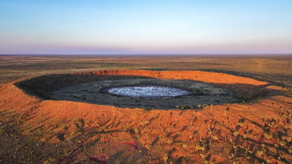
Joël Lapointe was planning a camping trip in Quebec’s Côte-Nord region in 2024 when he noticed something odd on Google Maps. A circular depression centered on Lake Marsal, roughly 25 kilometers wide, with terrain features that looked unlike the surrounding landscape. He took a screenshot, reported it to Impact Earth, a crowdsourcing website run by Western University in London, Ontario, and set in motion a chain of events that would confirm one of the largest meteorite impact craters discovered in years.
Planetary geologist Gordon Osinski, known to colleagues as “Oz,” visited the site in 2025. What he found confirmed Lapointe’s suspicion. The circular structure, provisionally named Uhackatik with approval from the Innu Council of Ekuanitshit in whose traditional lands it lies, shows clear evidence of a meteorite impact roughly 390 million years ago. Osinski found shock metamorphic effects, deformations to the rock caused by the extreme pressures and temperatures of an impact, and, more surprisingly, impact melt rocks.
“Impact melt rocks are like they sound: large volumes of rock that are melted by the impact event, but then cool and crystallize to look a lot like volcanic rocks,” Osinski told Space.com. “Finding these preserved, as they are usually some of the first parts of a crater to be eroded, was a big surprise.”
A crater of unusual preservation
The Uhackatik crater, located north of the Gulf of St. Lawrence, is approximately 25 kilometers (15 miles) in diameter, making it one of the larger impact structures discovered in recent decades. Osinski noted that the last discovery of comparable scale was the 31-kilometer (19-mile) Hiawatha structure in Greenland, spotted in 2018, though that crater remains controversial because it is completely buried by ice.
The preservation of impact melt rocks at Uhackatik is significant because it allows researchers to date the impact event and study the geochemical signature of the impactor. It also means the crater has not been substantially eroded since its formation, suggesting it was buried and protected for much of its 390-million-year history before being exposed by more recent geological processes.
Citizen science in the satellite age
The discovery is a case study in how freely available satellite imagery is transforming geological exploration. Google Earth and Google Maps, designed for navigation and urban planning, have become de facto geological survey tools. Amateur observers with trained eyes can identify features that professional geologists might miss because they are not looking at that particular patch of ground.
Impact Earth, the platform where Lapointe filed his report, was designed precisely for this purpose. It allows anyone to submit a candidate impact structure for expert review. The platform has received thousands of submissions since its launch; most are false alarms. Uhackatik is one of the confirmed exceptions.
The crater has been officially recognized with the approval of the Innu Council, who have authority over the territory. The name Uhackatik, drawn from the Innu language, reflects the cultural context of the land where the crater lies.
For Lapointe, what began as a camping trip detour has become a lasting contribution to planetary geology. The crater he spotted on a screen is now part of the scientific record, a reminder that the Earth’s surface still holds undiscovered stories, and that the tools to find them are increasingly available to anyone with an internet connection.